Navigation......................................
01.
Home
02.
General Lead Mining History
03a. Halkyn Mines: History
03b. Halkyn Mines: A few artefact photos
03c.
Halkyn Mines: info downloads
03d.
Halkyn Mines: Don Richardson - electrician
03e. Milwr Tunnel: Recent work
04.
MAP: Veins of Halkyn Mountain
05. Blaen-y-nant vein, Eryrys
06. Westminster vein, Eryrys
07. Fron Fownog Flats, Gwernaffield
08.
Pilkington's vein, Loggerheads
09.
North Henblas Mine, Milwr
10.
Deterioration of the mining record
11. Talargoch Mine
A.
Mines lighting old & new
B. Links
C. Further reading
D. Cris's Shop Window
05. Blaen-y-nant vein, Eryrys
Worked as Maen Di Gochwyn Mine and later as Britannia Mine
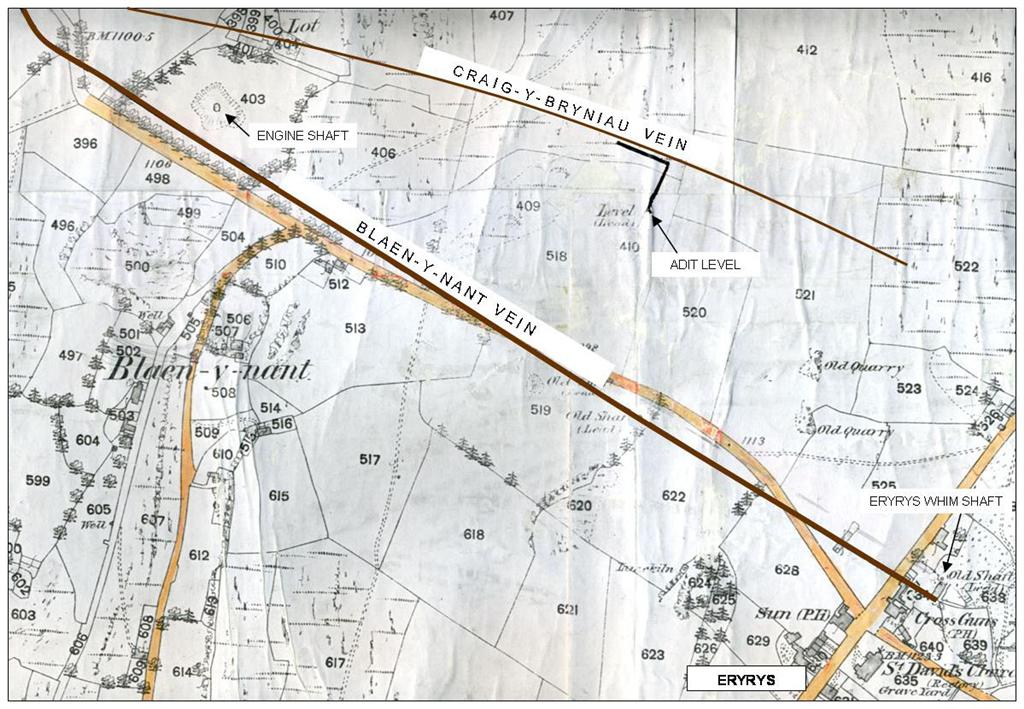
Extract from the 25":1
mile Ordnance Survey sheet of 1878 (first edition)
Click images to
enlarge, then BACK button to continue
Blaen-y-Nant vein is a little over half a mile in length but is
not thought to have been very productive. The vein was being worked
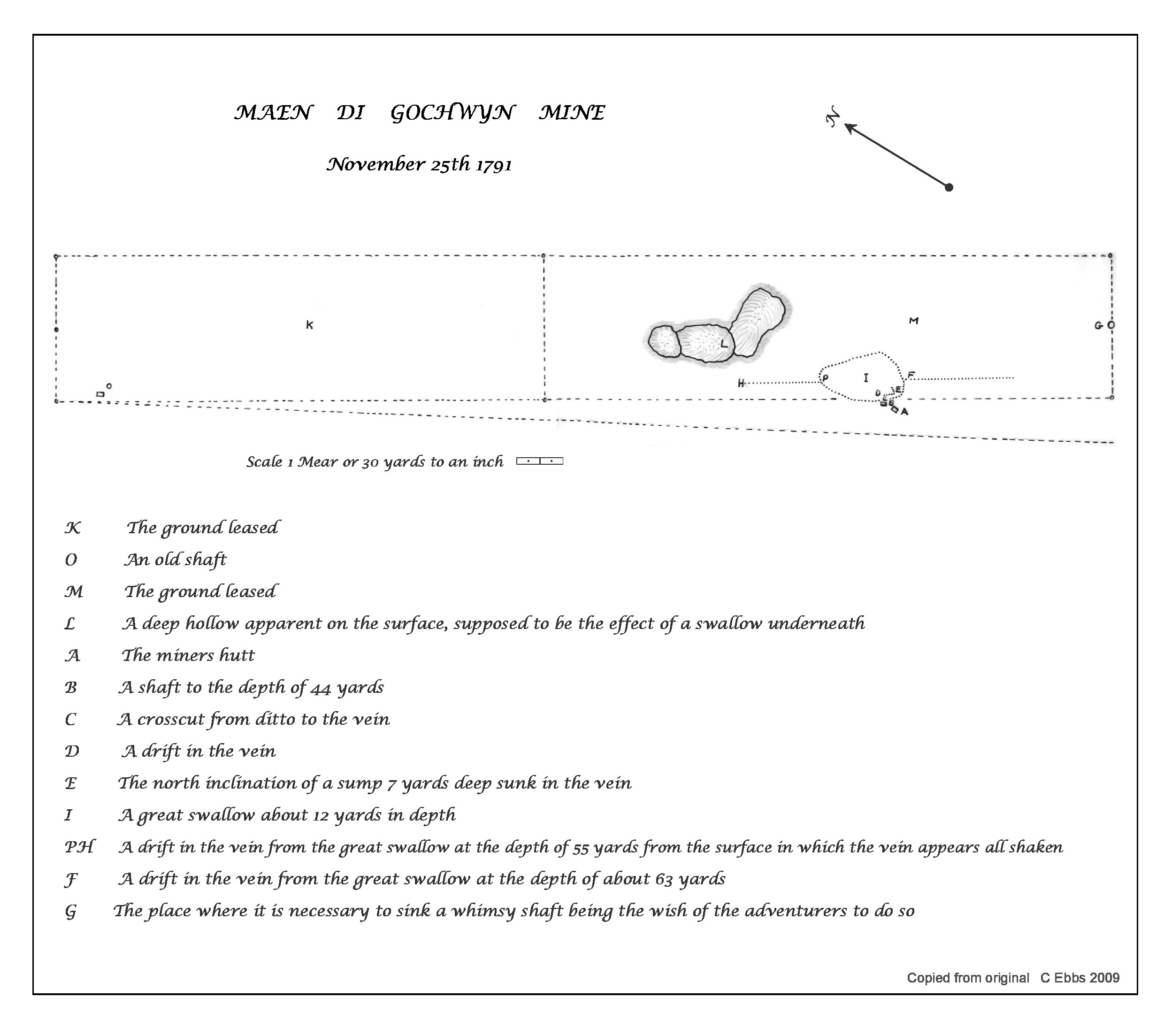
prior to 1791 when it was known as 'Maen di Golchwyn'. In 1843 it was
operated by 'Blaen-y-Nant Mining Company', but no production figures
have been seen. In 1863, the vein was being worked under the name of
'Britannia Mine' (see survey below).
The 1863 plan below forms part of a three year lease issued by Grosvenor
Estate granted to three businessmen from Mold to "Search for, raise,
dress and sell lead ore". The Estate demanded a royalty of 20
shillings (£1) a ton and stated that the mine must operate with "No
less than four able-bodied miners who shall be constantly employed in
prosecuting the works requisite to make an effectual trial of the ground".
It appears that this company sunk at least a further two shafts at Lot
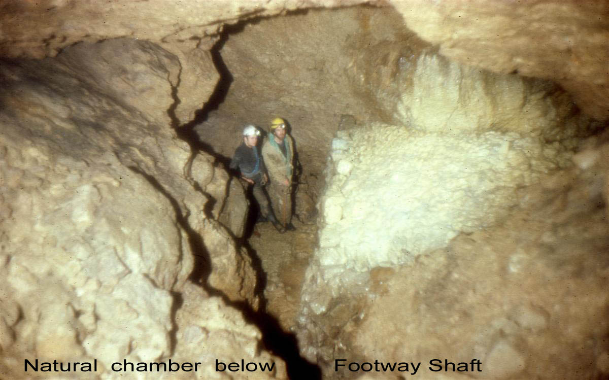
farm on the western end of the vein: Engine Shaft and a nearby Footway
Shaft (shown on the 1970s sketch on this page).
The name 'Lot Farm' refers to a miners 'lot': the name given by
miners to the royalty paid to a land-lord, originally being 1/12th or
1/13th or the ore raised.
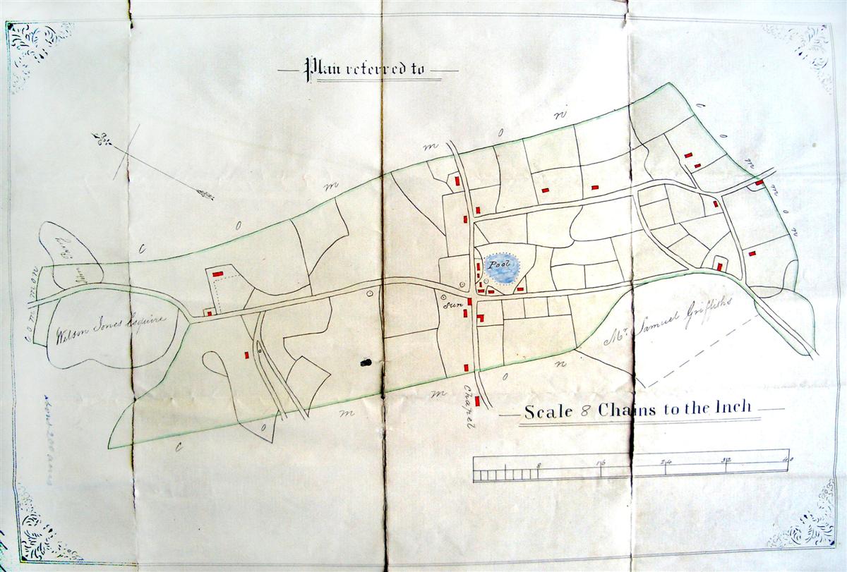
Area plan of 1863 showing several shafts, all of
which have now been capped or filled.
The plan forms part of a 'takenote' or lease for Britannia Mine (Flintshire Records Office ref: D/GR/1776).
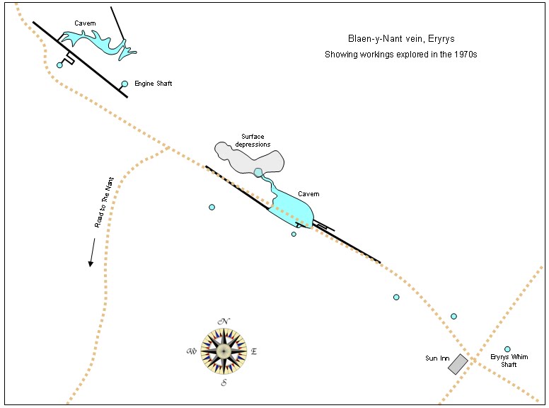
Main workings
The majority of
the workings on the main vein run eastwards from Pwll Helyg in the
west, past Lot Farm, to a little beyond Eryrys cross-roads. The main
(explored) shafts are Engine Shaft in the field in front of Lot
Farm; a nearby Footway Shaft; Thomas Evans Shaft near the sewage
works and Eryrys Whim Shaft about 50 metres due east of Eryrys
cross-roads. Several other shafts have been filled and a small mound
in the garden of a house just north of the cross-roads is a capped
and unexplored shaft (although previous inhabitants are known to
have emptied the ashes from their fires into it for many years).
The capped Eryrys
Whim Shaft at SJ204579 (take footpath beside red phone box for 20
yards) was descended after excavating beneath the concrete cap in
the 1970s to a boulder-blocked floor at a depth of 150 feet. Workings at the western end of the vein around Pwll Helyg comprise some open stopes in the cliff-face and one or two filled shafts, but no underground workings of any extent have been found in this area in modern times. The shaft shown on the plan above just above the 'S' of 'Sun' near the cross-roads had a large concrete cap over it, resting on top of a raised mound until about 2000 when the raised cap and mound was removed and a sub-surface concrete cap was installed, prior to selling the land
Drawing of workings accessible today
Branches off
the main vein
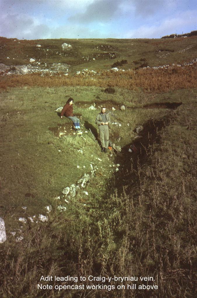
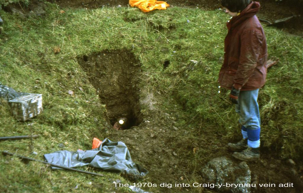
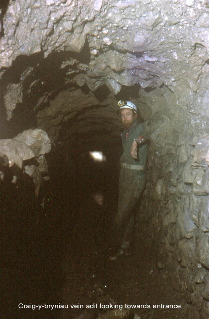
A little west of Lot Farm (SJ199583) the vein splits and an off-shoot known as Craig-y-Bryniau vein runs almost parallel to the main vein (see map at top of page). It can be seen as a line of old shafts and opencast workings running across the hillside between Lot Farm and Eryrys. A shallow adit level onto this vein is indicated by a short trench visible from the lane at SJ 202581. The adit entrance was dug and entered in the 1970s. It runs for around 30 metres to the vein where boulder blockages halt further progress at a very unpromising area. Permission to cross this land should be sought from Lot Farm (close to Engine Shaft).
A small branch
running south off the main vein was worked near Pwll Helyg
(SJ195587) but no details are known.
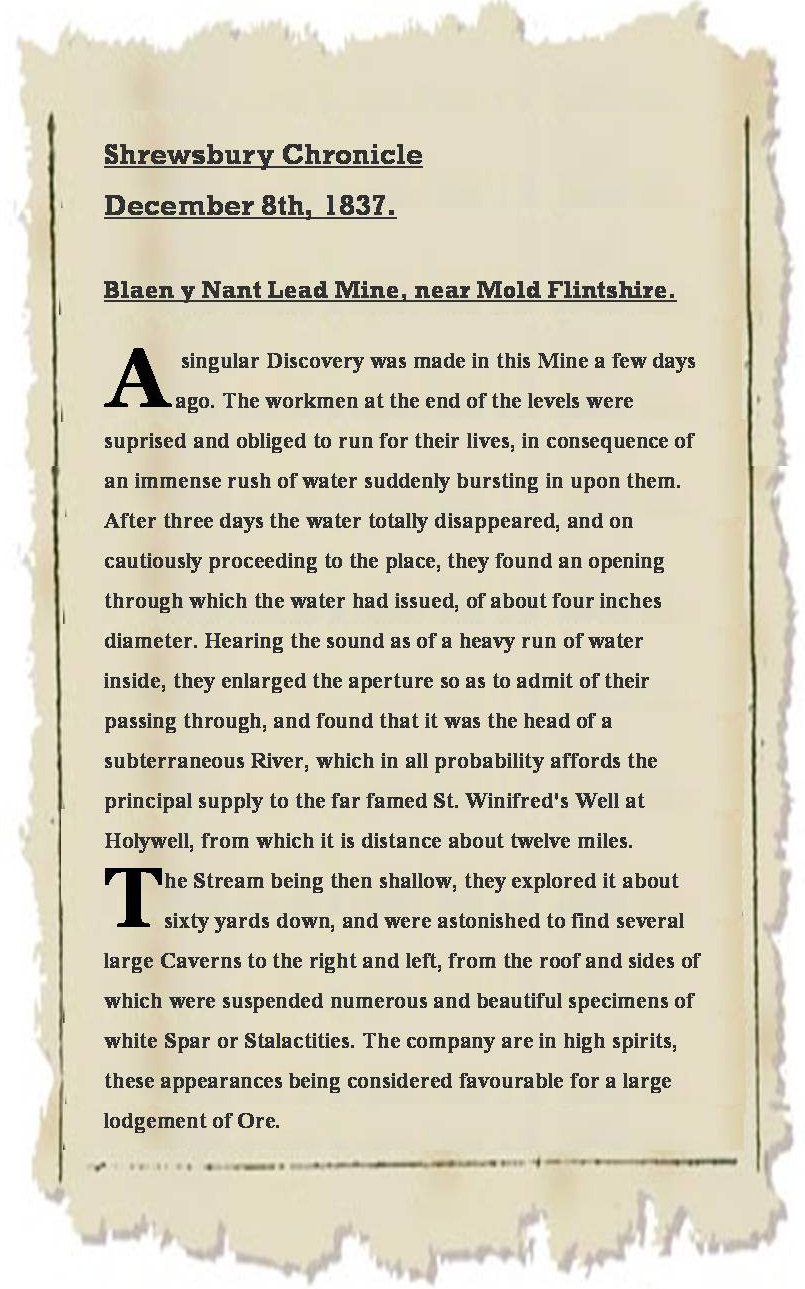
An early newspaper report described miners breaking into a flooded cavern on Blaen-y-Nant vein, stating that they were "obliged to run for their lives", Although the report refers to a river flowing through a large cavern, its precise location is not certain........
Thomas Evans
Shaft
An old mine plan
(below) shows that workings were being carried out from this shaft
prior to 1791, when the mine was called Maen Di Golchwyn. The shaft is
about 120 feet deep to a short level leading to an internal shaft of
about 40 feet which enters a large natural cavern. A stone in the wall
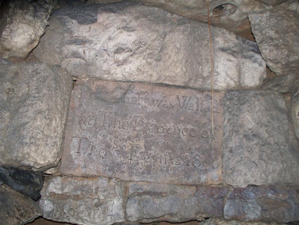
of the shaft is inscribed: “This shaft was walled at the expence
of Thos. Evans 1806”. As this stone post-dates the survey (showing
the shaft), it suggests that stone 'ginging' may have replaced timber
shoring in the top section of the shaft. It is not known if Thos.
Evans paid for the shaft financially or with his life!
In the 1980s, the clay floor was excavated to the north-west from
the natural cavern towards the feint sound of running water. This
broke through into a couple of chambers with unstable boulders
above, terminating under the large surface depressions. These are
used as a discharge point by the nearby sewage works; hence the name
Flush Pot. The surface depressions can be seen today and are shown
on the 1791 plan.
The earliest known plan of Blaen-y-Nant vein,
when it was worked as Maen Di Gochwyn Mine.
Engraved stone forming part of the shaft walling
about 3 metres below the surface (Photo: Ian Adams)
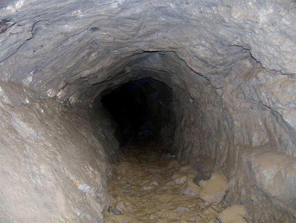
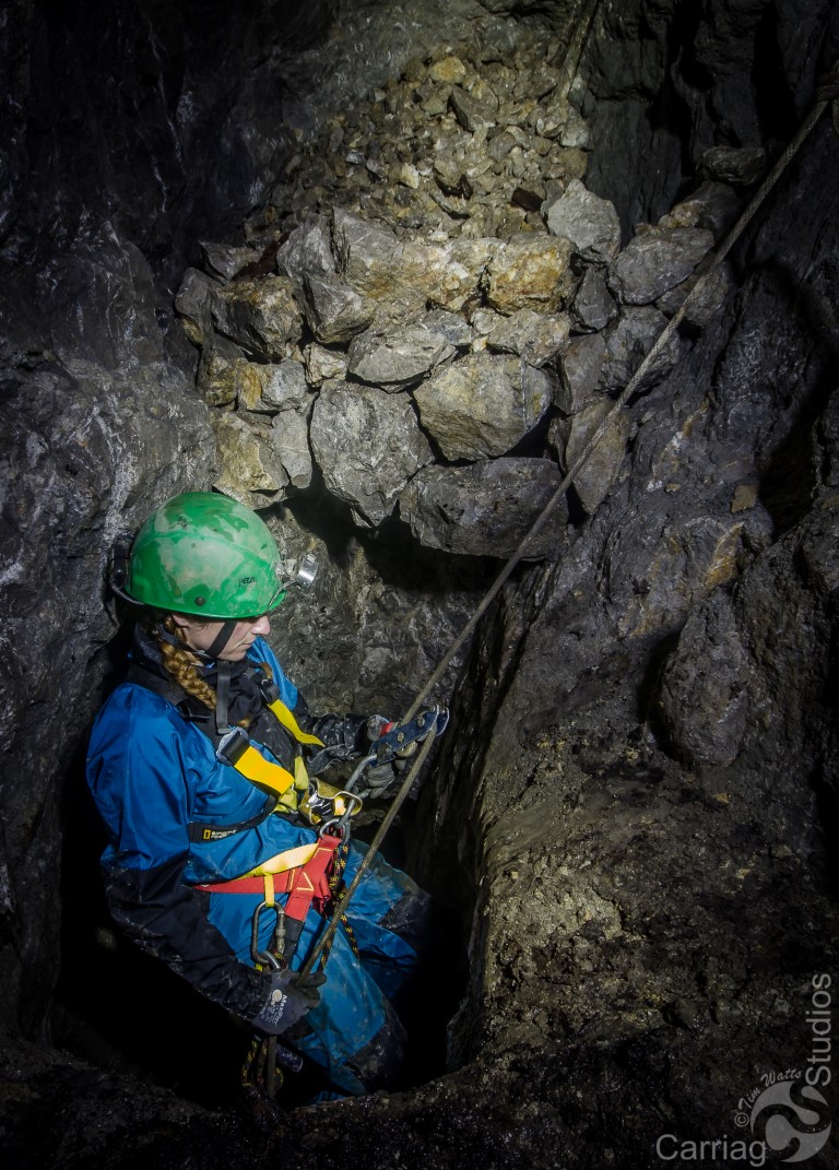
Deep Adit ? A deep adit runs south-east from near the River Alyn at SJ188593. Although this adit follows the line of Blaen-y-Nant vein, there is no documentary evidence showing that it connects with the main workings at Lot Farm or Eryrys. The entrance is well blocked, but a stream issues during severe floods. The adit can be entered however, via an open shaft (around 40 feet deep) in woods at approximately SJ189592. The adit runs for some distance and terminates at a chamber formed by collapse.
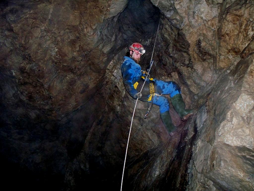
Abseiling into the naturally formed chamber from near the base of Thomas Evans shaft (Photo: Ian Adams)
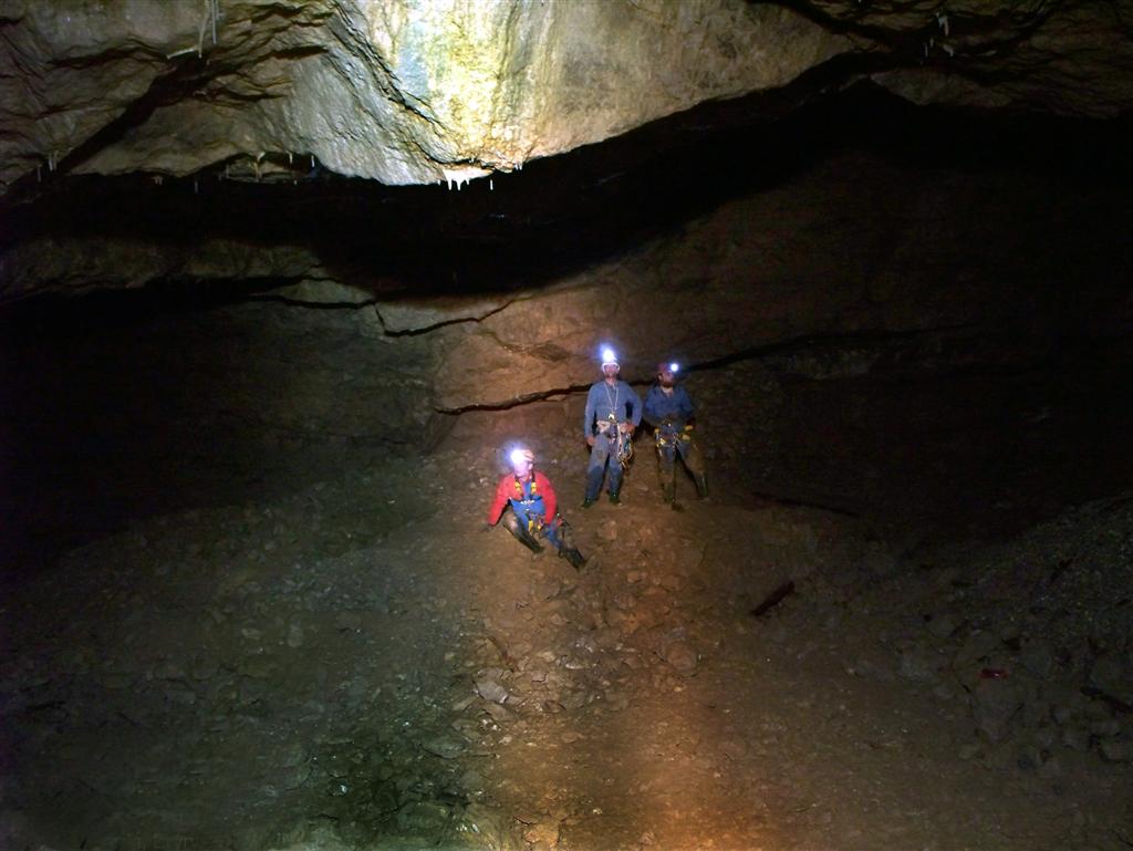
Passage looking west along the vein. Note the shot-hole in the roof (Photo: Ian Adams)
Natural chamber. Miners used this chamber to dump waste
rock. The depth of the original floor is therefore uncertain (Photo:
Ian Adams)
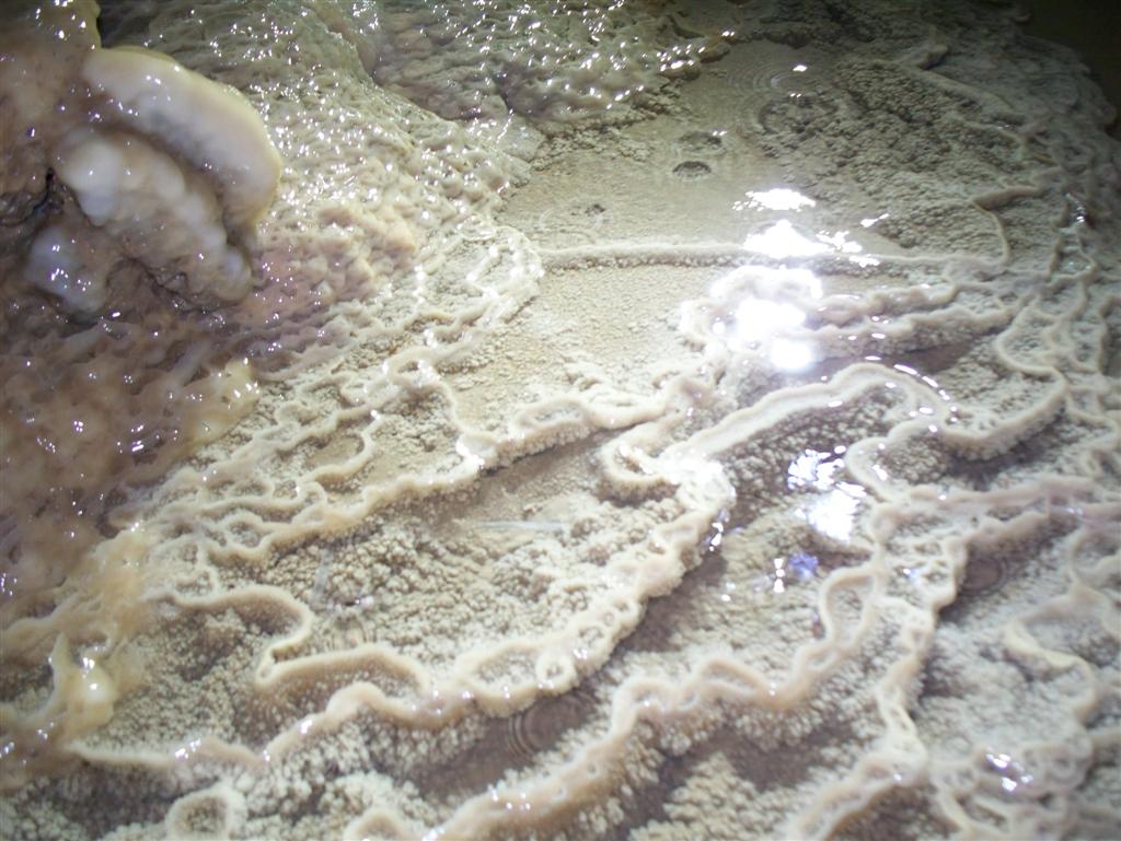
Small gour pools of calcite formed on the passage
floor (Photo: Ian Adams)
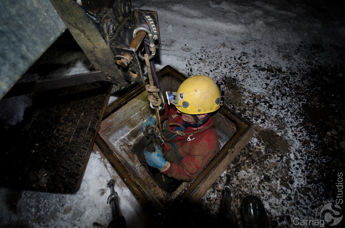
In January 2016 a shaft, previously undescended in modern times, was
examined by Tim Watts, Mike Leahy and others.
Its position is marked on Image 3 above, being the closest shaft to Eryrys Whim Shaft (north of the Sun Inn). As it now lies in the parking area of a new property, SRT rope was belayed to the towing hitch of a Land Rover. The following photos show the workings which comprise a series of short levels connected by vertical pitches..........
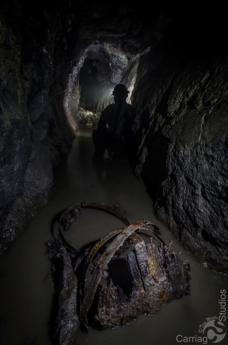
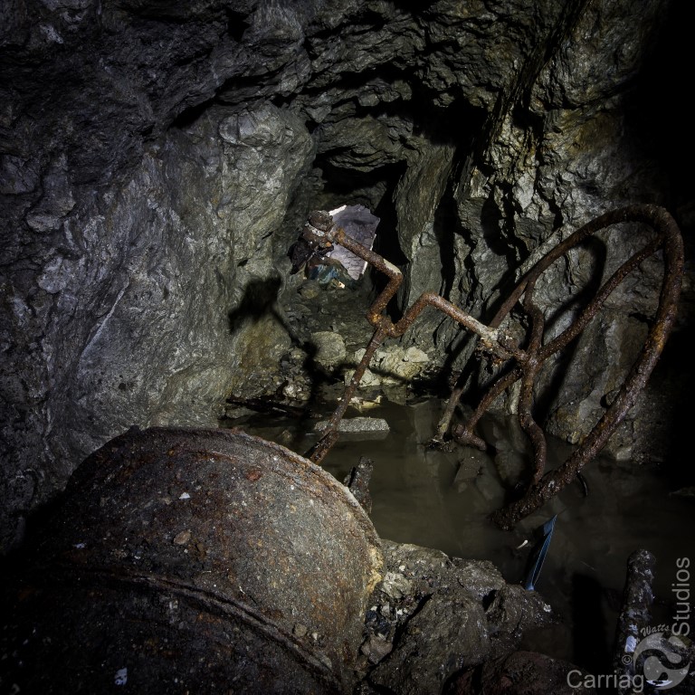
Entrance to 40m entrance shaft Photo: Tim Watts
Near bottom of entrance shaft Photo:
Tim Watts Remains of old bucket? Photo: Tim Watts
Old miners hand pump
Photo: Tim Watts
The mine may have been first explored by cavers in 1969 by
Derbyshire Caving Club.
Their journal for that year gives a three page account of their
exploration.
Free copies as a PDF file can be requested using the e-mail
address on the Homepage, with the kind consent of DCC.
_______________________________________________________________________________________________
Clwyd Powys Archaeological Trust refer to the mine working this vein as being:
Blaen-y-nant Mine "CPAT Historic Environment Record number 18008, grid reference SJ19905820"
Workings
"A line of early 19th century workings follow an east-west vein
from the Eryrys Crossroads to Lot's Farm, running parallel to and
north and south of the road. A single large shaft lies to the north
of the Eryrys Crossroads at SJ20405820 and has been documented as
the Eryrys whim; to the south-west of this and across the road in a
field behind the village hall lies another isolated shaft at
SJ20155805. The older workings are interspersed with the natural
limestone outcrops. The most western workings on the vein are at
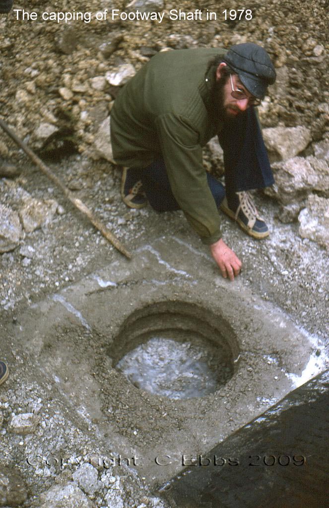
Lot's Farm. Two shafts were capped in the 1978 Capping Programme
carried out by N.K.C. At SJ19935827, a shaft and large whim circle
remain as a raised platform to the south-west of the farmhouse. At
SJ19845827, the ladder shaft, has an adjacent coe (miners' shelter).
The shaft lies in trees directly to the north-west of the coe The
1874 OS Map has the coe marked but not the ladder shaft and the whim
is marked as an earthwork. No reference is made to the sett as a
lead mine, which may have ceased operations by then".
Correction: The "miners coe" referred to by CPAT is simply a farm building associated with Lot (not 'Lot's) Farm. The building is shown on a land survey dated 1863, but the survey shows no footway shaft at this location. The 1st edition 25" Ordanance Survey sheet of 1878 also shows the building but no footways shaft there. The footway shaft was therefore sunk some time after 1878. Remains of a true miner's coe can be seen however within a few hundred metres on Westminster Vein (see page 11: Deterioration of the mining record).
|